What Cookeville's Floodplain Program Means for Your Fence Installation
What Cookeville's Floodplain Program Means for Your Fence Installation - a guide from Cookeville Fence Co., serving the Upper Cumberland region of Tennessee.
Cookeville sits on the Eastern Highland Rim, just west of the Cumberland Escarpment, and that geography shapes more than the view. The city's soil belongs to the Bodine-Baxter-Mountview association, a rocky, cherty subsoil that makes post-hole digging noticeably harder here than in softer ground like the Nashville Basin to the west. Cookeville has also held a rating in FEMA's Community Rating System (CRS) floodplain program since 2014, and the city keeps a published Sinkhole/Floodplain Report that documents real karst and flood interactions across parts of the area. If your property falls inside a mapped floodplain or sits near a known sinkhole feature, that matters before you put a single post in the ground.
Why the CRS Program Is Relevant to Fence Owners
Cookeville has held a Class 9 rating in FEMA's Community Rating System since 2014. The CRS program is a voluntary framework that rewards communities for floodplain management practices that go beyond the federal minimum. It's not a fence-specific ordinance, but it shows that Cookeville actively tracks and maps floodplain status. If your lot sits anywhere near a creek, drainage way, or low-lying area, check whether it falls inside a mapped flood zone before you finalize fence placement.
The city keeps a Sinkhole/Floodplain Report because Cookeville's karst terrain genuinely interacts with surface water in ways flat, non-karst ground doesn't. Karst areas can have subsurface drainage that isn't obvious from the surface. Combine that with mapped floodplain zones, and the ground under a planned fence line isn't always easy to read just by looking at it.
What This Means for Post Depth and Placement
Two separate factors stack up here. First, the rocky, cherty Bodine-Baxter-Mountview subsoil around Cookeville makes standard post-hole depths harder to hit without running into rock or chert fragments, and that changes how a crew handles footing and post-setting. Second, if a property sits in or near a mapped floodplain area, drainage and grading become part of the planning conversation in a way they wouldn't on high, dry ground elsewhere in Putnam County. Neither of these is a reason to skip fencing a property. It's a reason to walk the line first, see what the soil and the flood mapping actually say about that specific lot, and plan post spacing, depth, and material accordingly.
This is also where checking in with the Putnam County Codes and Planning Department or City of Cookeville Planning Department earns its place in the process. Depending on whether the property sits inside city limits or in unincorporated Putnam County, one office or the other handles permitting, and either one can tell you directly whether a given parcel falls inside a mapped flood zone.
Material Choices for Floodplain-Adjacent and Karst Terrain
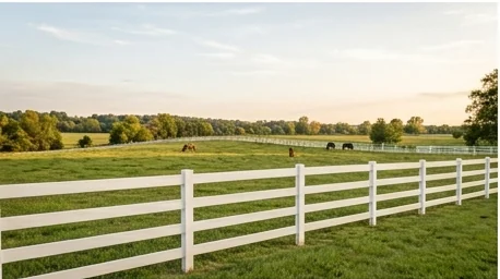
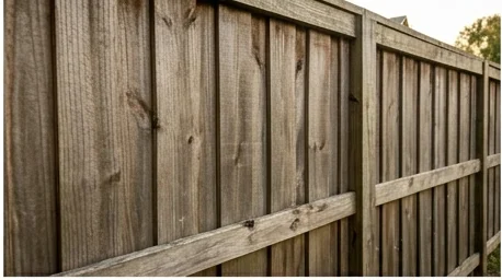
Material selection matters more on ground like this than on a flat, well-drained lot. Wood posts set in ground that periodically holds moisture from nearby drainage are more exposed to rot over time than posts on high ground. So if you're leaning toward wood fencing, proper post treatment and setting method deserve extra attention on these lots. Vinyl fencing doesn't carry that same rot risk and can be a practical option when drainage is a concern, as long as the posts are set correctly in the rockier subsoil. For a farm or acreage property where the fence line crosses varied terrain, some rockier and higher, some lower and wetter, split rail fencing is often set with methods better suited to inconsistent ground than a continuous solid-panel fence would be.
Whatever material you choose, the issue underneath is the same: know what the soil and flood mapping say about your specific line before it's cut.
Why a Site Walk Comes Before a Quote on Ground Like This
On a typical Cookeville lot with no floodplain overlap, a fence estimate is fairly routine. On a property that touches a mapped floodplain area or sits in a documented karst zone, the honest approach is to walk the property line first. That means checking the actual terrain, noting any low spots or drainage paths, and understanding what the city's floodplain mapping says about that specific parcel before you commit to a layout or a material. It also means a conversation with Putnam County or the City of Cookeville's planning office, since they hold the actual floodplain maps and can confirm permit requirements for the parcel in question.
None of this is unique to fencing. Any exterior improvement on a Cookeville property that touches floodplain-mapped ground benefits from the same due diligence. But a fence line often runs along property boundaries where drainage naturally collects, so it's a project where a quick site assessment upfront saves problems later.
If you're planning a fence installation on a Cookeville property near a creek, drainage area, or known sinkhole feature, our fence installation team can walk the line with you and talk through what the soil and terrain mean for your specific project. For fences on land already showing wear from ground movement or drainage issues, fence repair is worth a look before a full replacement. Get in touch to talk through your property.
Request a Free Estimate
Fill this out and we'll get back to you, or call or text (931) 651-8856.